
The C2C Cycle Route is an iconic 140-mile journey from the Irish Sea to the North Sea, offering breathtaking views of northern England’s diverse landscapes. Sustrans’ official PDF maps provide detailed route information, making them indispensable for planning an unforgettable adventure. Perfect for cyclists of all levels, this route promises an exhilarating experience.
Overview of the C2C Route
The C2C Cycle Route spans approximately 140 miles, connecting the Irish Sea in Cumbria to the North Sea in Tyneside. This iconic journey traverses diverse landscapes, from the stunning Lake District to the rolling Pennine hills. The route primarily follows quiet roads, traffic-free paths, and scenic trails, offering a mix of challenging climbs and rewarding descents. Cyclists pass through charming villages, historic sites, and picturesque countryside. The C2C is renowned for its accessibility to riders of all levels, with clear signage and detailed maps available to guide participants every mile of the way.
History and Popularity of the Route
The C2C Cycle Route, also known as the Sea to Sea Cycle Route, has a long-standing history dating back to its establishment in the early 1990s. It was created to connect the west and east coasts of northern England, offering cyclists a unique opportunity to explore the region’s natural beauty. Over the years, the route has gained immense popularity, attracting thousands of cyclists annually. Its appeal lies in its diverse terrain, scenic landscapes, and accessibility to riders of all skill levels. The route’s popularity is further enhanced by comprehensive resources, including detailed maps and guides, making it a beloved adventure for cyclists worldwide.
Key Features of the C2C Cycle Route
The C2C Cycle Route spans 140 miles, featuring a mix of on-road and traffic-free paths, offering cyclists diverse terrain and scenic views. The route includes challenging climbs, such as the infamous Hartside Pass, and gentle descents, making it suitable for both experienced and casual riders. Detailed maps highlight contour profiles, ensuring cyclists can plan for elevation changes. The route also offers optional loops and braids, allowing riders to customize their journey. With its well-marked signage and accessible amenities, the C2C provides an unforgettable adventure through northern England’s stunning landscapes, making it a must-do for cyclists of all levels.

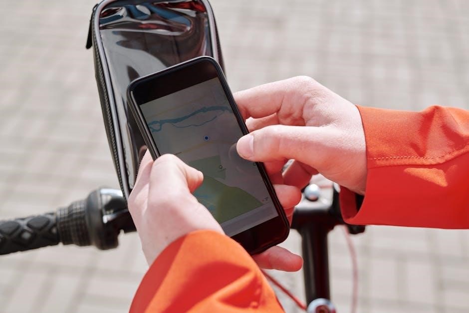
Official C2C Cycle Route Maps
Sustrans’ official C2C PDF maps provide detailed route information, including waypoints and elevation profiles, essential for planning your coast-to-coast cycling adventure in northern England.
Sustrans C2C Official PDF Maps
Sustrans’ official C2C PDF maps are comprehensive guides for cyclists, detailing the 140-mile route from the Irish Sea to the North Sea. These full-color maps highlight traffic-free paths, quiet lanes, and roads, with clear contours and route profiles. Detailed inset maps for major towns and cities help navigate urban areas. The maps are designed to be user-friendly, ensuring cyclists can plan their itinerary efficiently. They also provide essential information on elevation changes and scenic highlights, making them invaluable for both experienced riders and newcomers. Available for download or purchase, these maps are a must-have for a seamless C2C cycling adventure.
Features of Sustrans C2C Maps
Sustrans C2C maps offer detailed route information, including traffic-free paths, quiet lanes, and road sections. They feature clear contours and elevation profiles, helping cyclists prepare for challenging terrain. The maps include inset details for major towns, ensuring easy navigation through urban areas. Distance markers and key landmarks are highlighted, making it easier to track progress. Additionally, the maps point out essential services like bike repair shops and cafes. Available in both digital and print formats, they cater to all preferences. These maps are indispensable for planning and enjoying a smooth and memorable C2C cycling experience.
Downloading and Using Sustrans Maps
Sustrans C2C maps are easily downloadable as PDFs from the official Sustrans website or through their dedicated route planner app. These maps are compatible with mobile devices, allowing cyclists to access them on the go. The PDF format ensures offline availability, which is crucial for areas with limited internet coverage. Detailed instructions guide users on how to download and install the maps. Once downloaded, cyclists can zoom in for detailed views of the route, making navigation straightforward. The maps also include practical information such as distance markers, elevation profiles, and nearby facilities, ensuring a well-prepared and enjoyable journey from start to finish.
Planning Your C2C Cycle Adventure
Plan your C2C journey with Sustrans’ official PDF maps, offering detailed route insights and practical tips. Customize your adventure using online planners and resources for a seamless experience.
Using Online Route Planners for the C2C
Online route planners are essential for mapping your C2C adventure. Tools like Sustrans and cycle.travel offer detailed route customization, GPX downloads, and real-time updates. These platforms allow you to tailor your journey, explore detours, and sync routes with GPS devices. They also provide elevation profiles, helping you prepare for challenging sections. Additionally, online planners often include points of interest, bike shops, and accommodations. Using these resources ensures a well-organized and enjoyable trip. They are perfect for cyclists seeking flexibility and precision in their coast-to-coast journey across northern England’s stunning landscapes.
Essential Information for Route Planning
The C2C route spans 140 miles, offering a mix of terrain and elevation changes. Official Sustrans maps provide detailed route profiles, highlighting challenging sections and scenic highlights. Cyclists should note key landmarks like the Lake District, Pennine Hills, and River Tyne. The route is flexible, with options to start at Whitehaven, Workington, or other points. Essential information includes distances between stops, elevation gains, and bike-friendly accommodations. Maps also guide cyclists through urban areas and off-road sections. Understanding the route’s layout ensures a smooth journey, helping riders avoid busy roads and navigate with confidence.
Resources and Tools for a Successful Trip
Planning your C2C adventure requires reliable resources. Sustrans’ official PDF maps and online route planners are essential for navigating the 140-mile route. Guidebooks and GPX tracks provide detailed insights, while platforms like cycle.travel allow customization. Strava and bike-specific apps help track progress and performance. Additionally, cyclists can access lists of bike repair shops, accommodations, and eateries along the route. These tools ensure a well-prepared and stress-free journey, enabling riders to focus on enjoying the stunning landscapes and challenges of the C2C route.

Route Variations and Alternatives
The C2C route offers alternative start and finish points, loops, and braids, allowing cyclists to customize their journey across northern England’s diverse landscapes for a unique experience.
Alternative Start and Finish Points
The C2C route offers flexibility with alternative start and finish points, including Whitehaven, Workington, Newcastle, and Sunderland. These options allow cyclists to tailor their journey to suit preferences or logistics. Some riders opt for the Walney to Wear route, combining coastal sections with the main C2C path. Additionally, variations like starting at St Bees or ending in Tynemouth provide unique experiences. These alternatives maintain the route’s iconic charm while offering diverse scenery and challenges. Cyclists can choose routes that align with their fitness levels or interests, ensuring a personalized adventure across northern England’s stunning landscapes.
Exploring Loops and Braids on the Route
The C2C route features optional loops and braids, offering cyclists the chance to explore additional scenic paths and towns. These variations provide flexibility, allowing riders to customize their journey and experience more of northern England’s charm. For example, the Walney to Wear route adds a coastal section, while other loops take cyclists through picturesque villages or quieter landscapes. These alternatives are well-documented in Sustrans’ official maps and online resources, ensuring easy navigation. Exploring these extra paths can enrich the adventure, making the C2C journey even more memorable and tailored to individual preferences.
Customizing Your C2C Experience
Cyclists can tailor their C2C journey to suit preferences by selecting from various route options and detours. Official Sustrans maps highlight alternative paths, allowing riders to incorporate scenic diversions or shortcuts. Additionally, online tools enable customization of itineraries, ensuring a personalized adventure. Whether choosing quieter roads or exploring nearby attractions, the flexibility of the C2C route makes it adaptable for all cyclists. This customization enhances the overall experience, allowing riders to fully immerse themselves in the stunning landscapes and vibrant culture of northern England.

Navigating the C2C Route
The C2C route is well-marked with clear signage, while Sustrans’ PDF maps and GPX tracks provide detailed navigation support for cyclists of all experience levels.
Using GPX Tracks for Navigation
GPX tracks are a reliable tool for navigating the C2C route, offering precise digital routes compatible with GPS devices and apps. Downloadable from platforms like Sustrans or third-party sites, these tracks provide detailed waypoints, ensuring cyclists stay on course. They complement PDF maps by offering real-time guidance, reducing the risk of getting lost. Riders can upload GPX files to devices like Garmin or smartphones, enabling turn-by-turn directions. This method is especially useful for less experienced cyclists or those unfamiliar with the terrain. Combine GPX tracks with physical maps for a seamless and stress-free journey across the stunning C2C landscapes.
Understanding Route Markings and Signage
The C2C Cycle Route is well-marked with clear signage, including blue signs featuring a white cycle symbol and directional arrows. These signs are placed at regular intervals, particularly at junctions, to guide cyclists seamlessly. Additionally, mile markers and information boards provide insights into the route’s history and surroundings. While the signage is comprehensive, carrying a map or GPS device ensures you stay on track, especially in areas where signs might be less frequent. The consistent marking system, designed by Sustrans, makes navigation straightforward for cyclists of all experience levels.
Tips for Staying on Track
To stay on track during your C2C adventure, always carry a printed map or a GPS device with preloaded GPX tracks. Regularly check your progress against milestones like villages or landmarks. Be vigilant at junctions, as some signs can be easy to miss. Familiarize yourself with the route’s terrain and elevation changes to anticipate challenges. downloading the Sustrans C2C map PDF in advance ensures you have a backup plan. Additionally, inform someone of your daily route to ensure safety. By combining technology with traditional navigation, you’ll navigate the C2C route with confidence and enjoy the scenic beauty without stress.

Safety and Preparation
Ensure a safe journey by following safety guidelines, carrying essentials like a map and emergency contacts, and checking weather conditions. The Sustrans C2C map PDF is vital for route planning and emergencies;
Safety Guidelines for the C2C Route
Always plan ahead and check the route map for potential hazards. Carry emergency contacts and ensure your bike is well-maintained. Be prepared for varying weather and terrain conditions, as the route includes both on-road and off-road sections. Follow local signage and respect other trail users. Carry essentials like a first-aid kit, spare tires, and appropriate clothing. Stay informed about any route closures or updates before embarking. The Sustrans C2C map PDF provides detailed information to help you navigate safely and enjoy your journey.
Emergency Contacts and Services
Carry a fully charged phone and know the emergency contact numbers, such as 999 or 112 for critical situations. Familiarize yourself with local services, including nearby hospitals and bike repair shops along the route. Many villages and towns on the C2C route offer basic first aid and assistance. Use your Sustrans C2C map to locate the nearest help points or public facilities. Consider carrying a small emergency kit with essentials like a puncture repair kit and a basic first-aid kit. Always inform someone of your route and expected arrival time for added safety.
Weather and Terrain Considerations
The C2C route spans diverse terrains, from the rugged Lake District hills to the rolling countryside of the Pennines. Weather can be unpredictable, with frequent rain and strong winds, especially in higher elevations. Ensure you carry waterproof gear and layered clothing. Check the weather forecast before starting each day. Terrain varies between smooth cycle paths, gravel tracks, and quiet roads, requiring sturdy bikes with reliable brakes. Plan for regular stops to rest and refuel, as some sections are physically demanding. Always carry a basic toolkit and spare tires to handle unexpected terrain challenges.
Accommodation and Services
Along the C2C route, cyclists can find a variety of accommodations, from cozy B&Bs to budget-friendly hostels. Many establishments cater specifically to cyclists, offering secure bike storage and repair services. Additionally, numerous cafes and restaurants provide hearty meals to fuel your journey. Cycle repair shops are conveniently located in key towns, ensuring you can address any bike issues promptly. Plan your stays in advance, especially during peak season, to guarantee availability.
Places to Stay Along the Route
The C2C route offers a wide range of accommodations to suit all budgets and preferences. From cozy bed-and-breakfasts to budget-friendly hostels, cyclists can find comfortable places to rest. Many establishments are cyclist-friendly, providing secure bike storage and early breakfast options to kick-start your day. Additionally, some accommodations offer packed lunches and laundry facilities, catering specifically to the needs of long-distance riders. Booking in advance is recommended, especially during peak season, to ensure availability. Local tourism websites and route guides often list recommended stays, making it easy to plan your overnight stops.
Some popular spots include boutique hotels in historic towns and eco-friendly guesthouses nestled in scenic countryside. These options not only provide a welcoming atmosphere but also support sustainable tourism. For those on a tighter budget, camping sites and bunkhouses are excellent choices, offering basic yet convenient amenities. Regardless of your choice, the warm hospitality along the C2C route ensures a restful and rejuvenating stay after a day of cycling.
Cycle Repair Shops and Services
Along the C2C route, cyclists can access numerous cycle repair shops and services, ensuring help is never far away. Shops like Haven Cycles in Whitehaven and Cyclewise in Cleator Moor offer expert repairs, spare parts, and maintenance. Many establishments cater specifically to long-distance riders, providing quick turnaround times and essential services. Some shops even offer bike cleaning and servicing packages to keep your cycle in top condition. With repair services strategically located along the route, cyclists can tackle the journey with confidence, knowing professional assistance is available if needed.
Restaurants and Cafes for Cyclists
Along the C2C route, cyclists will find a variety of restaurants and cafes catering to their needs. From hearty breakfasts to energizing lunches, these establishments offer locally sourced food to fuel your journey. Popular spots like The Old Forge Tea Room in Cleator Moor and The Hub in the Lake District provide delicious meals and refreshments. Many cafes are cyclist-friendly, offering bike parking and outdoor seating. Enjoy traditional pub fare, homemade cakes, and specialty coffee to keep you going. These eateries are perfect for refueling and taking a well-deserved break during your adventure.
Environmental Impact and Sustainability
Minimizing environmental impact is crucial on the C2C route. Eco-friendly practices like reducing waste and staying on designated paths help preserve the natural beauty. Supporting local communities through sustainable tourism also promotes conservation and responsible travel.
Eco-Friendly Cycling Practices
Embracing eco-friendly cycling practices is essential for preserving the C2C route’s natural beauty. Carry a reusable water bottle, avoid single-use plastics, and pack waste until proper bins are available. Respect wildlife by staying on designated paths and avoiding disturbances to flora and fauna. Choose eco-conscious accommodations and support local businesses that prioritize sustainability. By adopting these practices, cyclists contribute to the route’s conservation and ensure its enjoyment for future generations. Sustainable tourism fosters a deeper connection with nature while promoting responsible travel.
Supporting Local Communities
Supporting local communities is a vital part of your C2C cycling adventure. Staying in local B&Bs, guesthouses, or hotels puts money directly into the local economy. Dining at cafes, pubs, and restaurants along the route helps sustain small businesses. Many villages and towns rely on cyclists for income, so shopping at local shops and using local cycle repair services is encouraged. By engaging with local residents and supporting their businesses, you contribute to the route’s vibrancy and ensure its continued appeal for future cyclists. This mutual benefit enhances your journey and fosters meaningful connections with the communities you visit.
Sustainable Tourism on the C2C Route
Sustainable tourism is key to preserving the C2C route’s natural beauty and ensuring its longevity. Cyclists are encouraged to adopt eco-friendly practices, such as using reusable water bottles and minimizing waste. Choosing accommodations with green credentials and supporting local businesses that prioritize sustainability can make a positive impact. By respecting wildlife and landscapes, cyclists help maintain the route’s pristine condition for future adventurers. Using digital maps like the Sustrans C2C PDF reduces paper usage, aligning with eco-conscious travel. These practices not only benefit the environment but also enhance the overall cycling experience, fostering a deeper connection with the route’s stunning landscapes.

Transportation and Logistics
Plan your journey with ease using transportation options like trains and buses, ensuring convenient access to the C2C route’s start and end points. Secure bike storage and parking solutions are readily available along the route, making logistics straightforward for cyclists. Use the official C2C cycle route map PDF to identify nearby stations and plan your travel efficiently, ensuring a smooth adventure from start to finish.
Getting to the Start and End Points
Reaching the C2C cycle route is convenient via public transport. The western start points, Whitehaven and Workington, are accessible by train, while Newcastle and Sunderland, the eastern endpoints, offer excellent rail and bus connections. Use the C2C cycle route map PDF to identify nearby stations and plan your journey. Regular train services connect these locations to major UK cities, making it easy to transport your bike. Booking tickets in advance ensures availability and convenience. Additionally, local bus services provide alternative options for cyclists traveling without cars, ensuring a seamless start to your adventure.
Transporting Your Bike
Transporting your bike to and from the C2C route is straightforward with proper planning. Use the C2C cycle route map PDF to identify nearby train stations and bike storage options. Many stations along the route offer secure bike parking or dedicated cycle sheds. When traveling by train, ensure your bike is packed in a suitable bag or box, and check with operators for bike carriage policies. For those driving, parking facilities near start points like Whitehaven or Workington are available. Plan ahead to ensure your bike arrives safely and ready for your adventure.
Storage and Parking Options
Secure bike storage and parking options are available along the C2C route, ensuring your bike remains safe during your journey. Refer to the C2C cycle route map PDF for locations with dedicated cycle storage, such as train stations or bike sheds. Many accommodations also offer secure bike parking for guests; Public parking lots near start points like Whitehaven or Workington provide convenient spots to leave vehicles while you cycle. Plan ahead by checking storage facilities near your route to ensure a worry-free adventure from coast to coast.
Congratulations on completing the iconic C2C cycle route! This journey from coast to coast offers unforgettable views and a sense of achievement. Use the C2C cycle route map PDF to plan your next adventure and explore more of northern England’s stunning landscapes.
Final Tips for a Memorable Journey
For an unforgettable C2C cycle adventure, download the Sustrans C2C official PDF map for detailed route insights. Use GPX tracks for seamless navigation and always carry a backup map. Check your bike’s condition before departure and pack essentials like tools, layers, and snacks. Respect the environment by following eco-friendly practices. Engage with local communities and enjoy their hospitality. Capture stunning views and share your journey on social media. Stay hydrated, pace yourself, and embrace the camaraderie of fellow cyclists. With proper planning and preparation, your C2C journey will be a truly rewarding experience.
Encouragement to Embark on the Adventure
The C2C cycle route is a must-do adventure for cyclists of all levels. From the stunning Lake District to the rolling hills and coastal views, this 140-mile journey offers breathtaking landscapes. With the Sustrans C2C official PDF map as your guide, you can confidently navigate the route. Embrace the chance to connect with nature, challenge yourself, and experience the camaraderie of fellow riders. Whether you’re seeking adventure, relaxation, or personal achievement, the C2C route promises unforgettable memories. Don’t hesitate—start planning your trip today and get ready to pedal your way across northern England’s iconic scenery!